
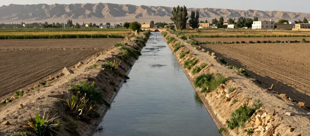
In the Fergana Valley, a canal beside a road is not just a detail in the view. Water channels, cultivated land, and settlements belong to a geography shaped by rivers flowing down from surrounding mountains. The valley extends across present-day Uzbekistan, Kyrgyzstan, and Tajikistan, so the landscape is larger and more connected than any single border on a map.
Notice where water travels
From a train window or a roadside stop, follow the changes between built-up places and cultivated ground. Irrigation is part of how agriculture takes shape here, but the local pattern is not uniform across the valley. A canal, orchard, or field tells you something about this particular stretch of land, not the whole region.
Keep the map in perspective
National borders can make the valley look like a set of separate destinations, while rivers and everyday connections follow different lines. That does not erase the importance of borders or local histories; it is a reminder that geography rarely fits neatly inside them. When traveling between towns, check current crossing and transport information rather than assuming that nearby places are easy to reach.
Look beyond the passing view
A short stop beside a canal can prompt better questions than a quick photograph: where does this water come from, how is this land used, and what changes from one district to the next? Seek answers from local sources and take care not to turn working places into scenery alone. The valley becomes more legible when you notice both its physical connections and the people who live with them.